Big Creek Gulf Hydrology
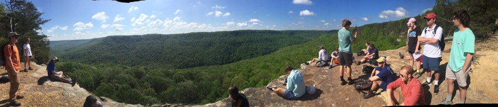
View from Stone Door down into Big Creek Gulf.
One of the best places to witness karst hydrology and beautiful scenery is within the Savage Gulf State Natural Area near Beersheba Springs, Tennessee. Here, three deep gulfs cut by stream erosion dissect the Cumberland Plateau like the imprint of a giant crow’s foot. Big Creek has carved out one of these gulfs and is best accessed via the Stone Door.
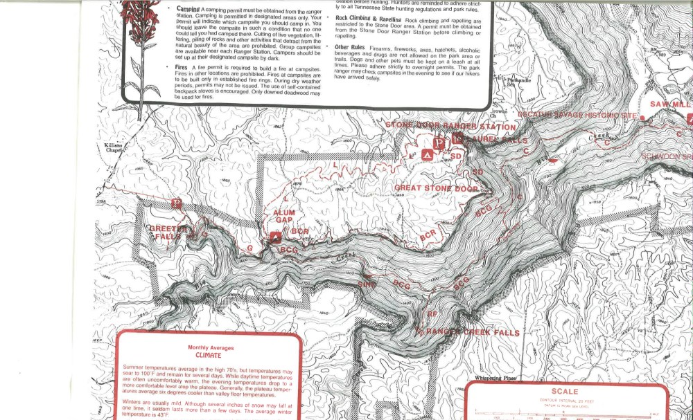
From here one passes through a large joint in the Warren Point Sandstone to drop more than 600 feet along the Big Creek Gulf Trail (BCG trail on map) to the rocky bed of Big Creek. About 100 yards downstream from where the BCG trail meets the creek, several large springs emerge from the hillside on the other side of the stream. This is also the contact between two major rock layers of Mississippian age – the Bangor Formation above and the Hartselle Formation below.
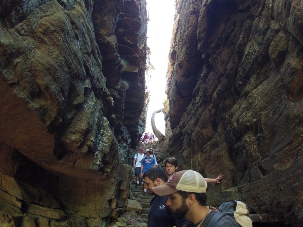
Passing through a large joint (the “Stone Door”) to get down to Big Creek.
The occurrence of springs at this stratigraphic level is no coincidence. The overlying Bangor Formation is mainly limestone that has been heavily chemically weathered and contains many cave passageways. The underlying Hartselle Formation, on the other hand, is a calcite-cemented, quartz sandstone with no karst development. It forms an impermeable boundary to groundwater flow and the downward development of caves within the Bangor.

Spring emanating from the contact of the Hartselle and Bangor Formations on the banks of Big Creek.
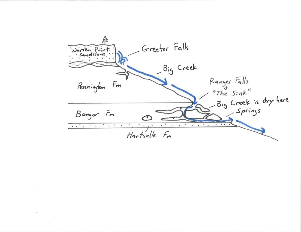
Highly simplified cross-section showing relationship of hydrology to geology along Big Creek.
Moving upstream from the springs the bed of Big Creek is dry. The imbricated and polished rocks of the bed, along with high water debris lines and bent over trees clearly indicate that there is a vigorous flow of water here at certain times.
Dry bed of Big Creek above the springs and below Ranger Falls and “The Sink.”
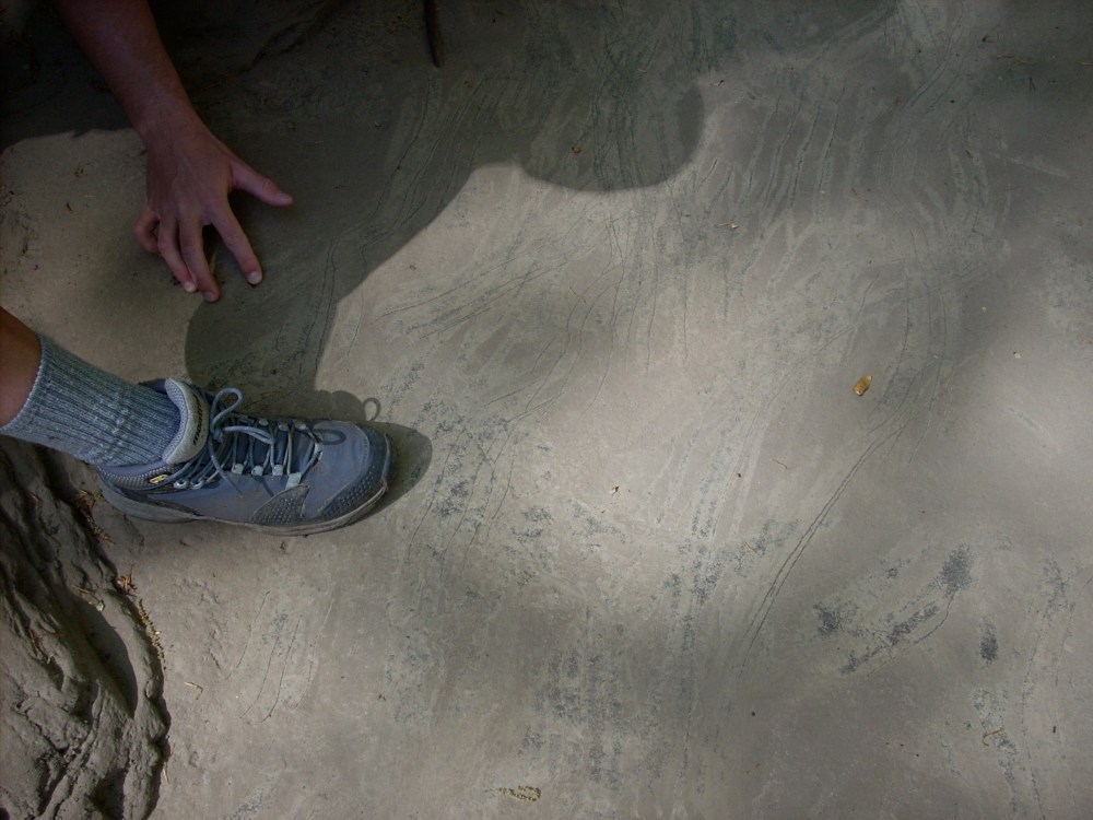
A boulder in the dry bed of Big Creek showing the recent claw marks of a black bear.
Further upstream at both Ranger Falls and “The Sink” (see map above), one is greeted with the sound of flowing water. Both places mark the top of the Bangor Formation where it contacts the overlying Pennington Formation. Here water flowing across the surface of the relatively impermeable Pennington quickly disappears into the caverns of the Bangor.

Big Creek water disappearing into caverns within the Bangor Formation at “The Sink.”
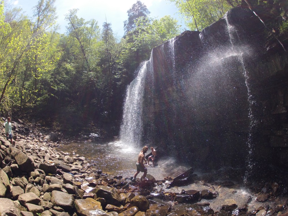
Ranger Falls, where water cascades over cliffs of the Pennington Formation and dives into a cavern system in the Bangor Formation.
Because the Pennington Formation contains numerous shale layers interbedded with limestones and dolomite, it does not conduct groundwater to the extent that the Bangor does. It also has far fewer and smaller caves. Upstream from “The Sink” Big Creek flows above ground and, for the hiker, culminates at Greeter Falls. During heavy or prolonged rains, the karst system of the Bangor Formation is overwhelmed by water and Big Creek is characterized by a continuous flow along its entire length. Thus the karst hydrology is best detected during relatively dry periods.
