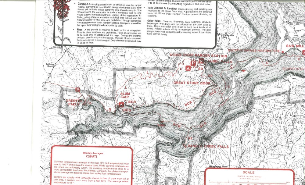
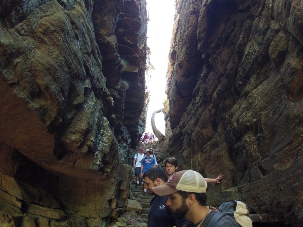
History of Water Use in Sewanee
Modified heavily from Knoll, M.A., Potter, D.B., Jr., and Van De Ven, C., 2015, Geology, hydrology, and water use history atop the Cumberland Plateau in the Sewanee and Tracy City, Tennessee area, in Holmes , A. E., ed., Diverse Excursions in the Southeast: Paleozoic to Present; Geological Society of America Field Guide 39, p. 197-218.
Water has always been the most precious resource on the University of the South’s 5260-ha campus (also called the “University Domain”). It is no surprise that many of the oldest traces of human habitation in Sewanee are immediately adjacent to springs. Many of the more than 200 prehistoric sites found beneath sandstone rock shelters on the university campus have provided diagnostic artifacts and radiocarbon dates indicating habitation as far back as the early Archaic (Knoll, 2004; Sherwood et al., 2011, 2012). The existence of perennial springs and their location also controlled the direction of university growth since its founding. In October 1857, the month before the actual site for the university was selected, Bishop Leonidas Polk, one of the university’s founders, wrote university engineer Colonel Charles Barney, asking him to “fix with accuracy” the location of springs “on the height of the land.” During the ceremony of the laying of the university cornerstone in 1860, speaker Matthew Maury held up a glass of Tremlett Spring water, stating that in it one might recognize “a drop of the very same water which watered the garden of Eden when Adam was there” (Smith and Suarez, 2008, p. 68).
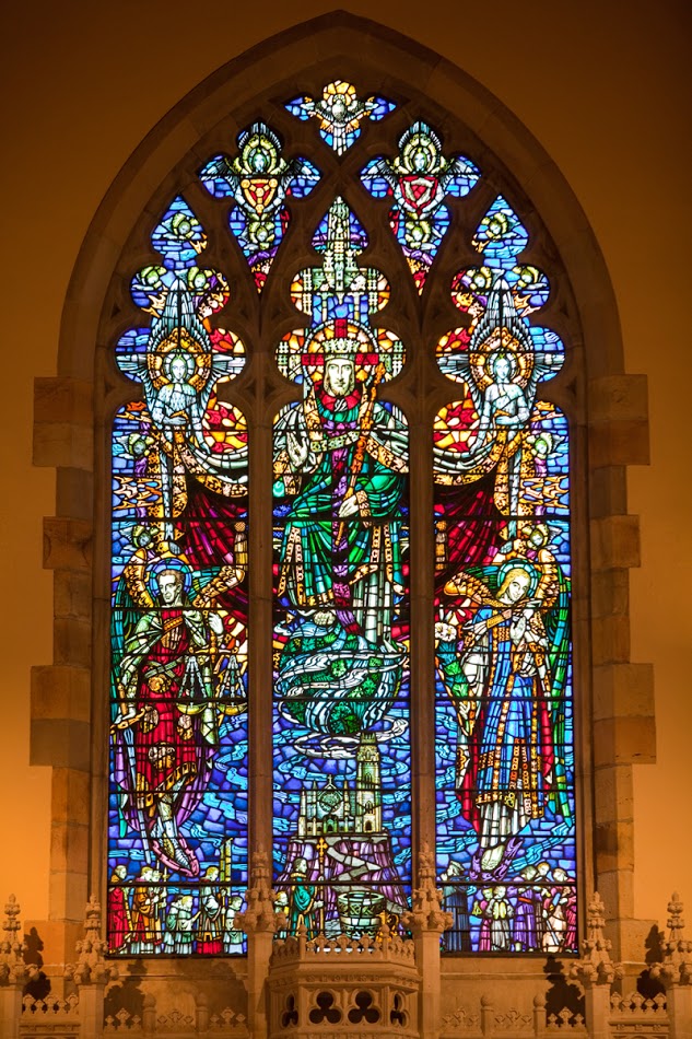
The window above the high altar in All Saints’ Chapel, together with two other windows, forms a triptych of the fifth-century hymn “Te Deum Laudamus.” The blue swirls of creation emanating from beneath Christ appear as streams of water, washing and purifying the Earth – and the Cumberland Plateau below.
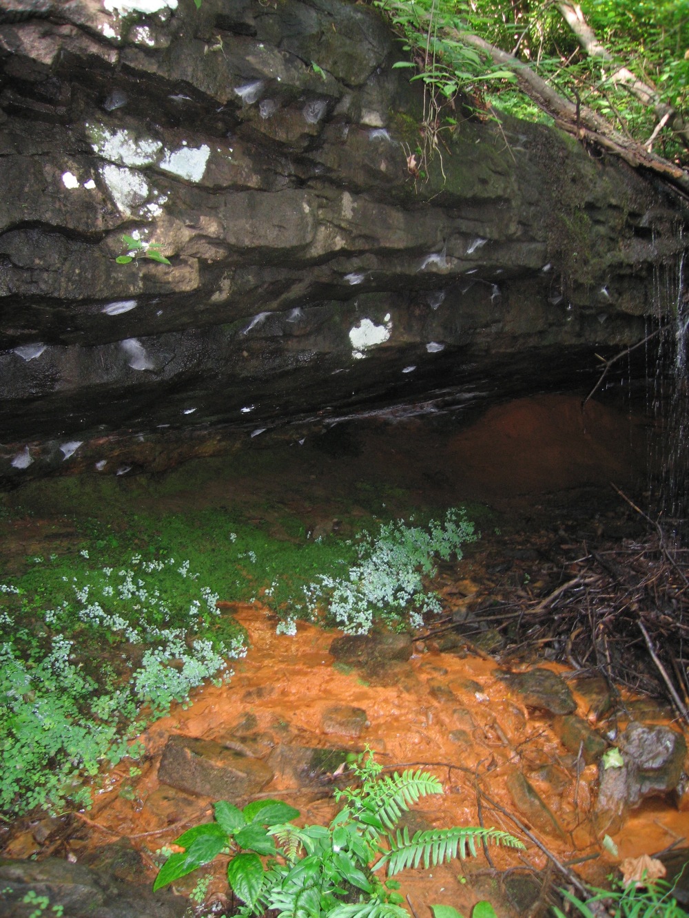
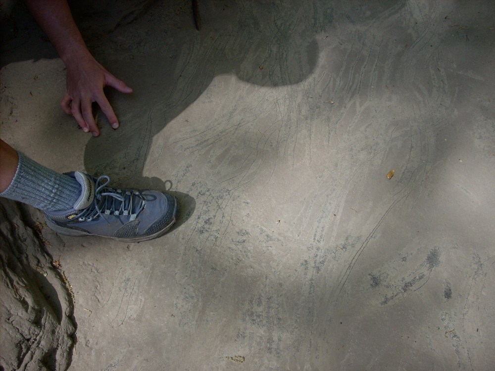
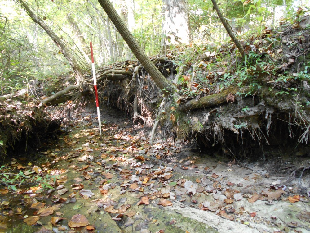
In 1861, the board of trustees directed that the land around springs be reserved, and the soon-to-be-accepted convention was that areas within 50 feet (15 m) of a spring were to be undisturbed. Washing and “other domestic uses” within this radius were prohibited in 1869. The earliest structures on the domain were of necessity close to reliable springs, most of which emanated from bedding planes in the Sewanee Conglomerate. Here, settlers fashioned small stone basins, most now degraded and eroded, in order to store the spring water for dipping with buckets or for pumping to nearby houses (Fig. 11). One of the first recorded buildings in the area, Rowe’s Tavern appears on Barney’s 1858 Platte of the University of the South sketch as having been constructed within a few feet of the largest perennial spring, Tremlett Spring (known then as Polk Spring). This tavern was situated on the main stage road between Nashville and Chattanooga and coincides with the present location of the Fowler Center (gymnasium/natatorium) in the upper portions of Abbo’s Alley (Knoll and Potter, 1998). During the Civil War, as many as 15,000 troops of both Confederate and Union armies alternately camped near Tremlett Spring (Pennington, 1950). A Federal soldier’s letter reads:
We are encamped upon the top of the Cumberland Mountains. The Second Brigade, on the site of the grand Southern University that was to have been, and our brigade about one and a quarter miles [2.5 km] farther south … Near our quarters is a very large spring of the clearest and finest water I ever drank. (Headquarters Third Brigade, Fourth Division, Fourteenth Corps, University Place, Tennessee, Friday, 7 August 1863, cited in Pennington, 1950)
After the Civil War, the University of the South and town of Sewanee began to grow with the first residences, dormitories, and classroom buildings located in proximity to Tremlett and other springs west of University Avenue. Today, the oldest structures are clustered along this line of perennial springs. The celebrated football team of 1899 always took two barrels of Tremlett Spring water with them on road trips, as “it was calculated to offset dietary changes and inactivity” (Chitty and Chitty, 1978, p. 91). By 1897, the university had established a waterworks that included a 63,000 gallon (238,000 L) cistern connected to Polk (now known as Tremlett) and Otey Springs in Abbo’s Alley. Steam pumps lifted the water to a 5000 gallon (19,000 L) tank in Breslin Tower on central campus, and water was distributed to university buildings and eight private houses. This improvement was a great convenience for residents and students, and also aided in firefighting and in the reduction of insurance rates (Potter, 2008).
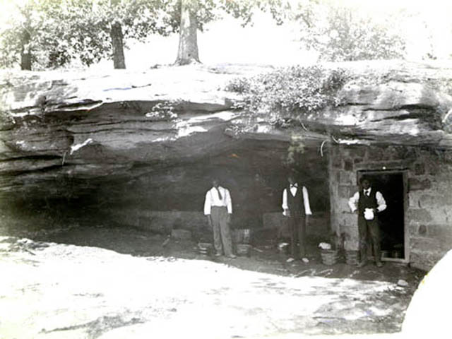
Tremlett (Polk) Spring during the 1890s. Notice the extensive masonry impoundment under the cliff of Sewanee Conglomerate. Source: University of the South Archives.
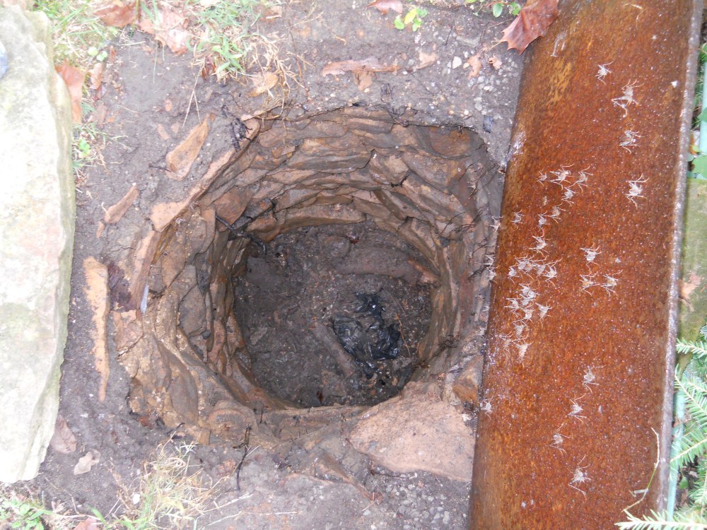
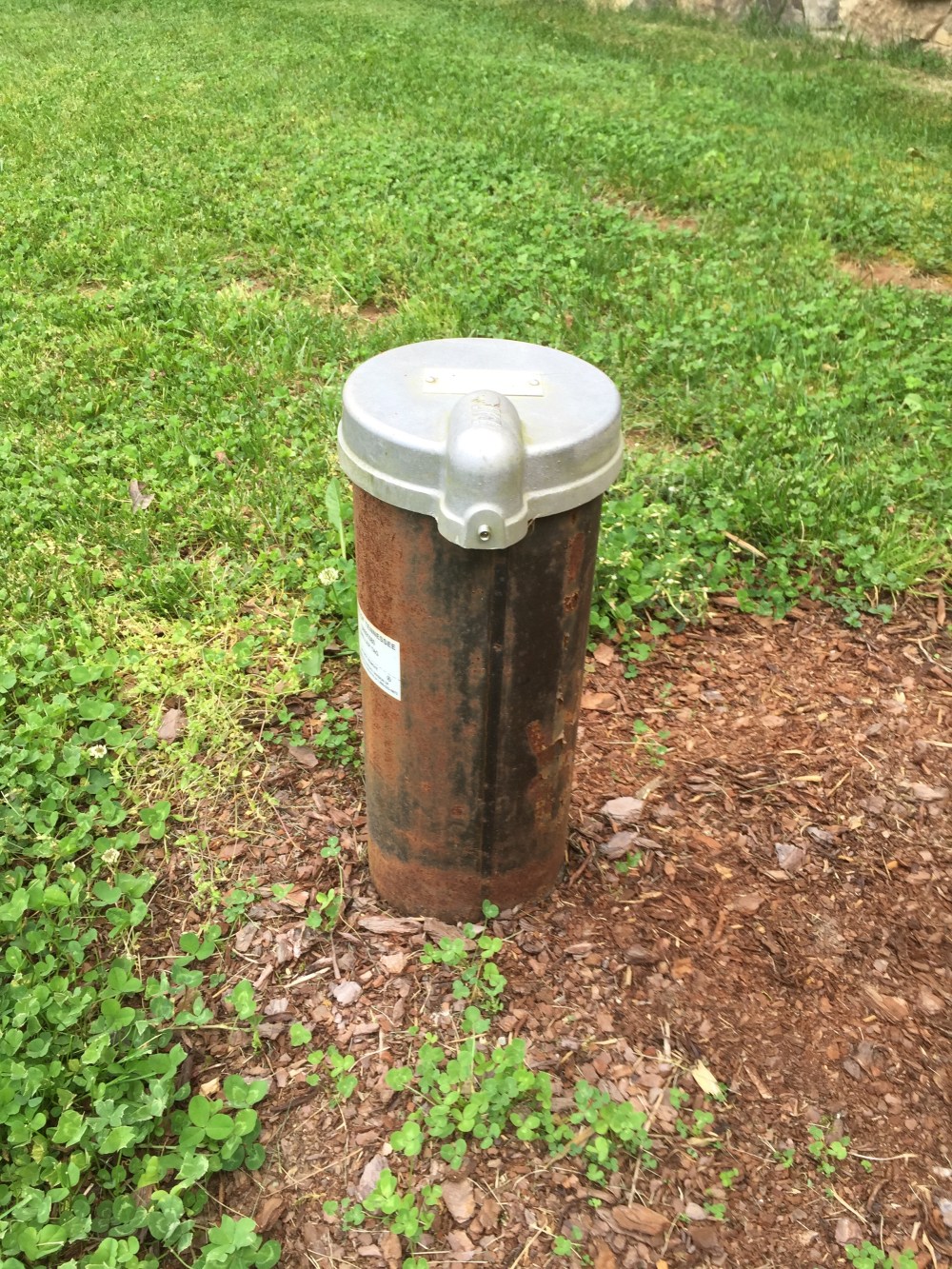
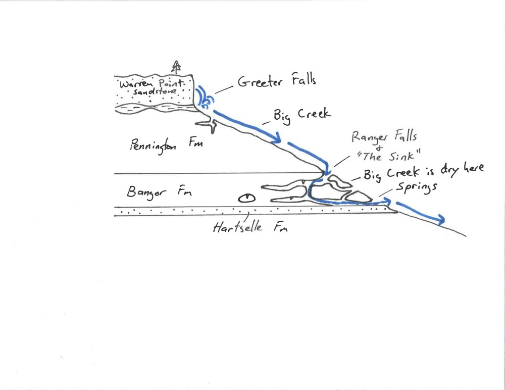
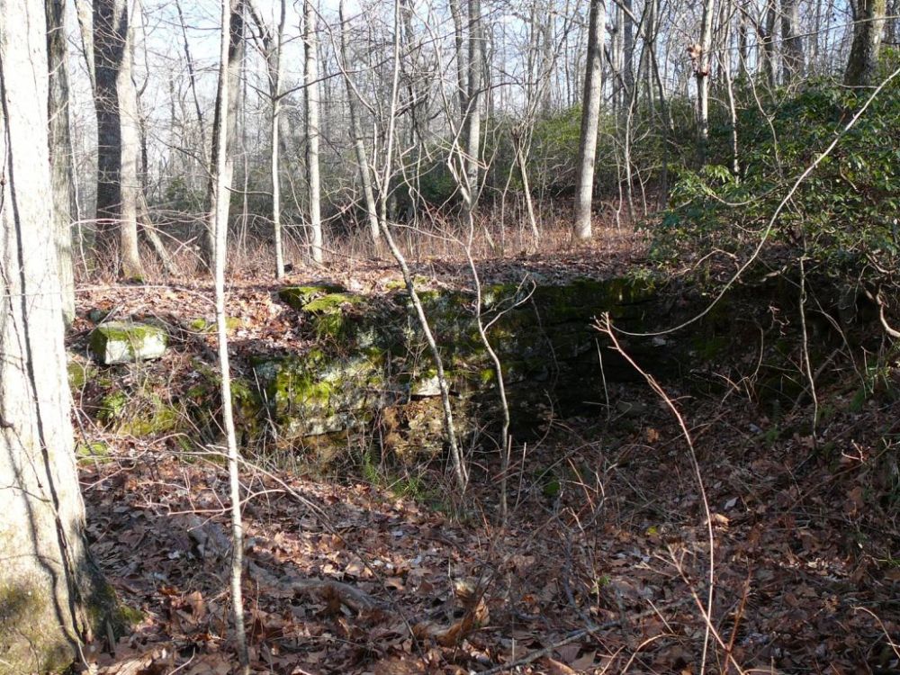
It appears that water flow from these springs has been relatively constant since the establishment of the university. In 1893 (cited in Potter, 2008, p. 15), early Tennessee geologist James Safford—who three decades before had done reconnaissance work on the water in the area with Bishop Polk and others—cited a letter from General E. Kirby Smith (university professor and former Confederate officer), which stated that until recently he had thought the clear water of the Polk (Tremlett) and Otey Springs flowed at a nearly constant volume, but during a drought year there was a signifi- cant drop in volume. Smith’s calculations agree well with measurements taken recently at Polk (Tremlett) Spring and mentioned above. The Xanadu Spring, historically the only source of water for Xanadu house located on the bluff between Sewanee and Piney Point, supplies clear drinking water in small volumes. According to former resident, Colonel Armistead Boardman its flow significantly decreased after the blasting of the Sewanee Conglomerate for the nearby highway in the 1950s (Potter, 2008, p. 15). The purity of the water was of constant concern in early years. In 1886, Dr. John Arnold, the university health officer, strongly urged the trustees to compel students and residents to dispose of slop water properly, noting that the “present method of throwing filthy water anywhere back of the house” was dangerous, presenting a particular risk to the quality of water in wells and small catch basins excavated in the surface soils along stream axes. The latter were lined and roofed over with stone, and attest to the relative scarcity of potable water atop the plateau in pre-reservoir times (e.g., Gregg Spring shown below).

Gregg Spring. One of the many impoundments designed to collect soil water for consumption.
The Committee on Sanitation responded at the same meeting and further recommended the construction of cisterns to store rainwater. On this important theme, the Committee on Water Works report of 1893 is compelling: “erection of a permanent system of Water Works, using the waters of our deep flowing springs, would do more to advance the general welfare and best interests of the University, in all its varied details, than perhaps treble the same expenditure in any other indicated way.” The concern was that Sewanee’s reputation as a healthy place had recently been shaken, “whether justly or unjustly,” and that to ignore this development “would be almost a fatal mistake.” The committee cleverly—and justly—argued that the waterworks would be a kind of “practical endowment” essential for Sewanee to move forward, her “life blood flowing in healthful and regular beat.” The following year, the Committee on Sanitary Measures registered satisfaction that sanitary conditions prevailed on the domain (Potter, 2008, p. 16). In 1898, the university health officer stated: “The presence of a case of typhoid fever last term shows that we have a constant menace in our water supply.” He called for a chemical analysis of “suspected” springs and wells. The following year, the university reported on the “happy condition” of a healthier community. Vice-Chancellor Wiggins takes special note in 1899 of the “most careful attention” given to sanitation, including the removal of human waste to the area near the farm, and he points to an editorial in the American Journal of Health “citing Sewanee as a model sanitary town” (Potter, 2008, p. 16). These concerns continued through the early part of the twentieth century until a sewer system was established. University engineer Robert Black’s 1919 map (University of the South Archives) shows the main sewer lines constructed in 1917 and 1918 and graphically depicts Sewanee’s location on a dissected “table land”: the three disposal plants, all near the bluff, mark low points for drainages radiating toward the west, north, and south. Each plant consisted of a large concrete vault with three chambers and opened to “contact beds” below, the equivalent of the modern leach field, and a great improvement from the days of the privy and the task of scavenging waste.

One of the three disposal plants from 1916-17, located along Laurel Drive near the old Hodgson dam site.
A more modern treatment plant was eventually built at the head of Depot Branch at the north end of Lost Cove, and today this serves as a collecting site for waste that is pumped to the spray irrigation site on the western edge of the plateau administered by the Sewanee Utility District. Sewanee’s appetite for water soon grew beyond the capacity of the springs and shallow wells. During the 1880s, the first attempts at dam construction atop the plateau commenced. These dams consisted of large rectangular blocks of hand-hewn sandstone stacked across drainages. The upstream, interior dam faces were coated with a thin veneer of cement to prevent leakage between the blocks. One such dam, Hodgson dam, was 30 m long, 1 m wide, and a maximum of 3 m high. In addition to supplying water, this shallow pond provided a measure of fire protection and a source of ice when winters were cold enough. The dam broke catastrophically in 1910, providing a memorable episode in resident Ely Green’s boyhood (Green, 1966, p. 176) as he checked his traplines below Morgan’s Steep: “I heard crashing and rumbling up the canyon, and a cracking of timber. I stopped and stood against the end of a big boulder. Soon I saw an avalanche of branches rolling down over the waterfall, and then a pillar of water fifteen feet [5 m] high dropped over the fall with a churning motion … I clung to the boulder as water raced around me waist deep … I soon sensed the Hodson’s [sic] Dam had broken.”
Sandstone blocks from the remains of Hodgson dam.
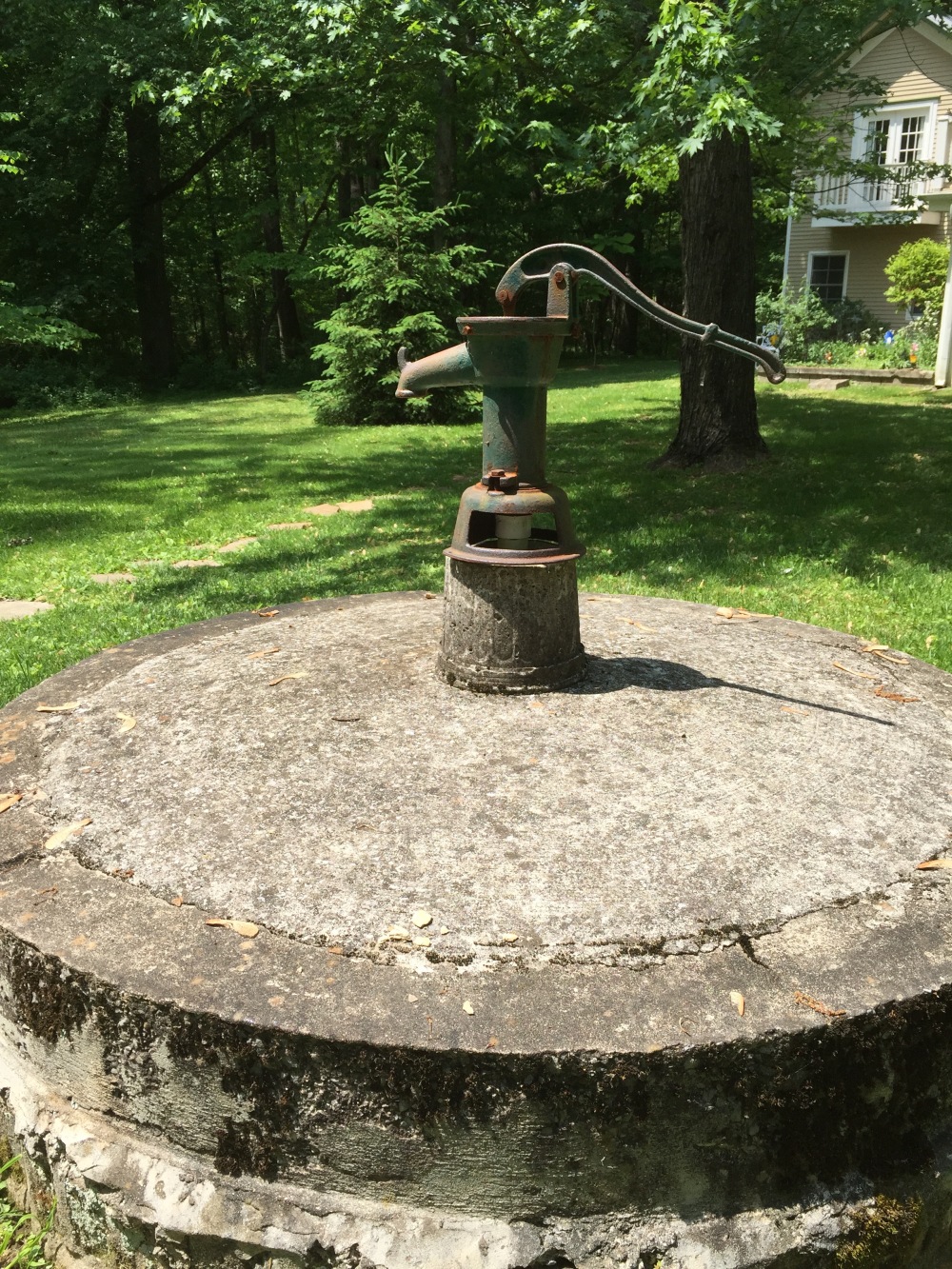
Other similar dams in the area suffered the same fate, thus ending the university’s first attempts at reservoir construction. Many other improvements were made in the domain water supply through the 1950s. Chief among the changes was a series of deep wells, shown on university engineer Robert Black’s 1922 map (University of the South Archives) of the downtown and campus areas. Wells ranged from 11 to 47 m deep, and a series of pump stations delivered water throughout the town. Fire hydrants were sprinkled liberally along University Avenue in the central campus, and a 380,000 L tank was installed near St. Luke’s Hall. The total output of all springs and wells in the early 1950s was estimated to be ~380,000 L/day. Realizing that any significant growth in the university would require an expanded water supply and that groundwater wells provided too little water (average of 15 L/min), the university began a second, more successful phase of dam construction. Earthen dams were now constructed across first-order drainages, with the first reservoir being completed in 1953 at a cost of $800.

Construction of Lake O’Donnell in 1953. Earthen dam is complete.
In 1955–1956, a municipal water supply reservoir was completed and, after installation of a filter plant below the dam, water from this reservoir became part of Sewanee’s municipal water network. By the end of 1963, the last spring and last well went out of service, and the town depended solely on the reservoirs for its water supply (Potter, 2008). As demand increased, the dam was raised, now impounding a total of 300 million liters of water. It soon became apparent that another reservoir would be necessary to ensure a never-failing water supply. Thus, a new, 490 million liter reservoir was constructed. Later, 12 more campus reservoirs were constructed through the 1960s. Many were established in the northwest part of the domain to attract wildlife and to be used for firefighting. The reservoirs also provided opportunities for fishing, bird-watching, and even occasional ice-skating. Today, the reservoirs provide 1.3–1.5 million liters of water to the university community per day.

Lake Jackson, one of Sewanee’s reservoirs.
REFERENCES CITED
Chitty, A.B., and Chitty, E.N., 1978, Sewanee Sampler: Sewanee, Tennessee, Proctor’s Hall Press, 198 p.
Green, E., 1966, Ely: An Autobiography: New York, Seabury Press, 236 p.
Knoll, M.A., 2004, Occurrence and management of geoarchaeological resources on the campus of the University of the South, southern Cumberland Plateau, Sewanee, Tennessee: Geological Society of America Abstracts with Programs, v. 36, no. 5, p. 240.
Knoll, M.A., and Potter, D.B., 1998, Introduction to the geology of the Sewanee, Tennessee area, in Schindel, G.M., and Hickman, J.L., eds., Journeys through TAG: 1998 National Speleological Society Convention Guidebook: Huntsville, Alabama, National Speleological Society, p. 144–152.
Pennington, E.L., 1950, The battle at Sewanee: Tennessee Historical Quarterly, v. 9, no. 3, p. 3–29.
Potter, D.B., 2008, How firm a foundation: Sewanee’s Domain, in Smith, G.L., and Williamson, S.R., Jr., eds., Sewanee Perspectives: On the History of the University of the South: Sewanee, Tennessee, University of the South, p. 7–46.
Sherwood, S.C., Carmody, S.B., Bow, S., Hollenbach, N.P., Knoll, M.A., Blankenship, A., and Cressler, A., 2011, Preliminary results from Uzzelles rock shelter: An Archaic and Woodland upland site in Sewanee, Tennessee, in Proceedings of the 23rd Annual Meeting of the Southeastern Archaeology Conference: Nashville, Tennessee.
Sherwood, S.C., Carmody, S.B., Herrman, N.P., Knoll, M.A., and Bow, S.M., 2012, Sandstone rockshelter site formation on the southern Cumberland Plateau of Tennessee: Geoarchaeology, archaeobotany, artifact analysis and remote sensing, in Proceedings of the 77th Annual Meeting of the Society of American Archaeology: Memphis, Tennessee.
Smith, G.L., and Suarez, S.T., 2008, The loveliest village: Gown and town in Sewanee, in Smith, G.L., and Williamson, S.R., Jr., eds., Sewanee Perspectives: On the History of the University of the South: Sewanee, Tennessee, University of the South, p. 47–110.