Uncategorized

Why we’ve pulled the plug on well water on the Plateau

IMG_1710

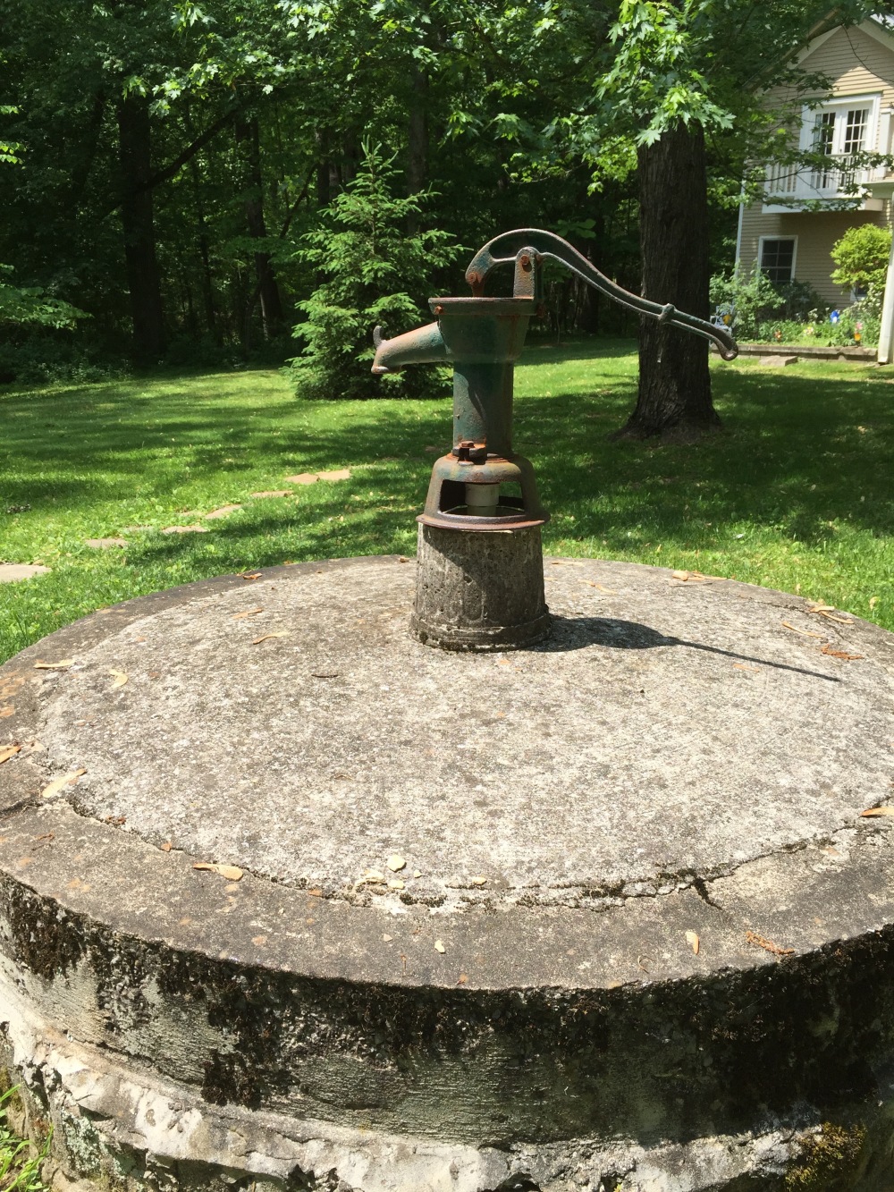
An old, shallow well in Sewanee.


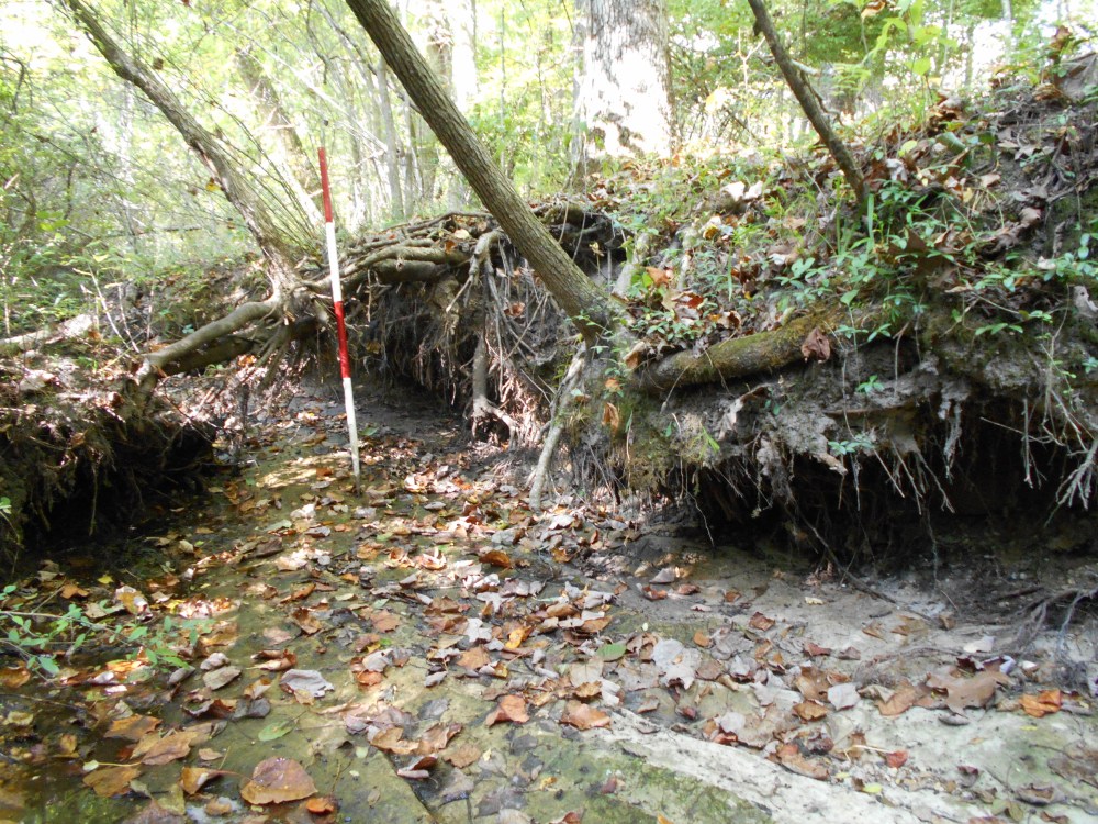
Before we successfully built the first modern reservoirs in the Sewanee area in the 1950’s, well water was an important component of our water supply along with the few perennial springs in the area. The first wells were hand-dug, extending down through the soil and then through as much of the weathered bedrock as the well diggers could manage. These old wells (like the one pictured above) typically ranged in depth from 20 to 35 ft. A rare glimpse into a well behind and old residence on University Ave. and in the woods on “Billy Goat Hill” in Sewanee reveal that the structures were rock-lined and between 3 and 4 feet in diameter (see photo below).

askew well

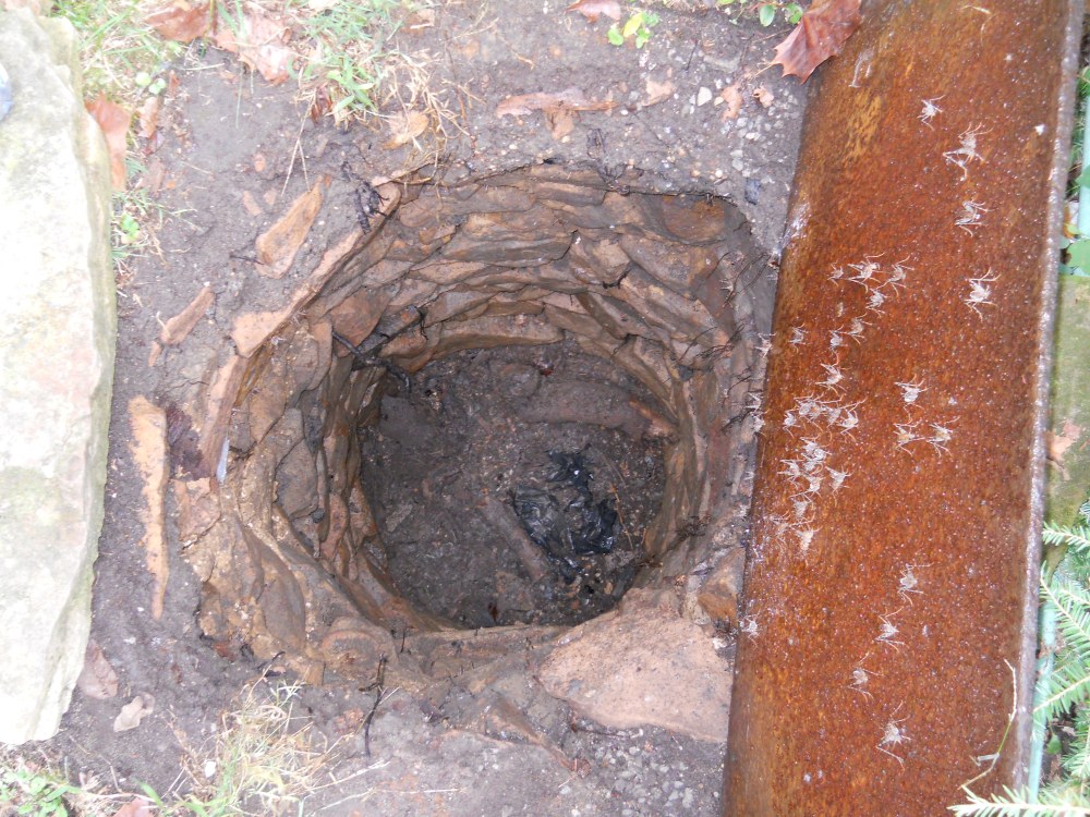
Interior of a long-abandoned, mostly infilled, rock-lined well in Sewanee. The rock lining presumably extended down through the soil until bedrock was reached.

The rock lining would have prevented collapse of soil into the well and presumably did not extend into the bedrock to any great distance. Upon completion, the well was capped with a lid and a pipe moved water from the well bottom to the surface via a hand-operated pump. These old wells were problematic for two main reasons. The first is that their shallow nature meant they would run dry when the water table dropped due to drought or seasonal decline during dry periods of the year (summer and fall). The second issue is that they were not sealed off (or cased-off in well driller speak) from the surface. That meant that surface water, along with any contaminants it carried, could easily infiltrate the well. During heavy rains one can sometimes hear water pouring from the surrounding soil down into these old wells. This was not a good arrangement if a privy or concentration of animals was near the well.

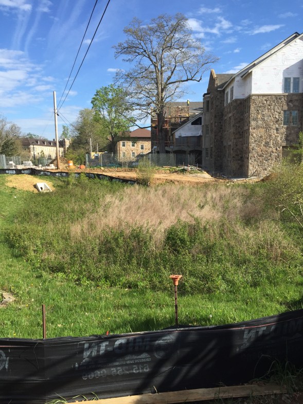
Today wells are drilled with much greater ease using compressed air drilling techniques, so that a well over 100 ft. deep, penetrating hard sandstone, can be completed in just a few hours.

drilling

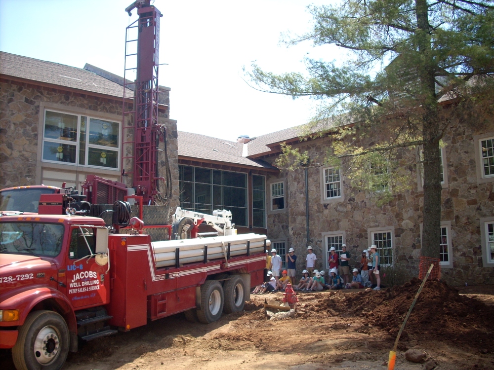
A 100 ft.+ deep well being drilled on the campus of the University of the South in Sewanee.

These wells are cased off for the first 21 ft., so that there is little chance of surface water  entering the well. Below are field notes showing the construction of a modern well in Sewanee:

notebook

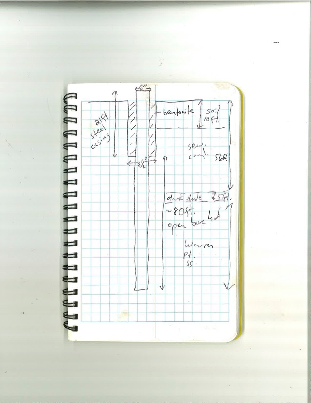
The field notes show that a 8.5 inch diameter hole is first drilled through the soil and then into the bedrock to a depth of 21 ft. Steel casing (a steel tube) of 7 inches diameter is then placed in the larger hole. The space around the outside of the steel casing is then filled with a bentonite slurry. Bentonite is a swelling clay and forms a tight, waterproof seal around the steel casing. Now a 6 inch diameter hole is drilled to the desired depth below the water table. In most cases the borehole is left unlined, with the firmness of the rock preventing the hole from collapsing.

IMG_1711

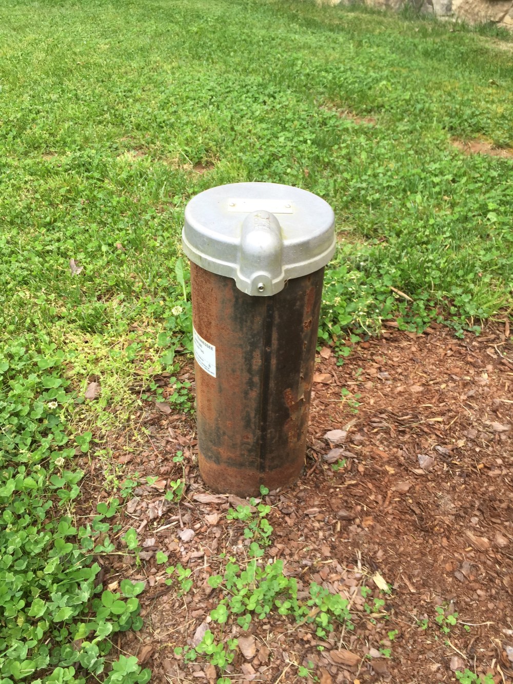
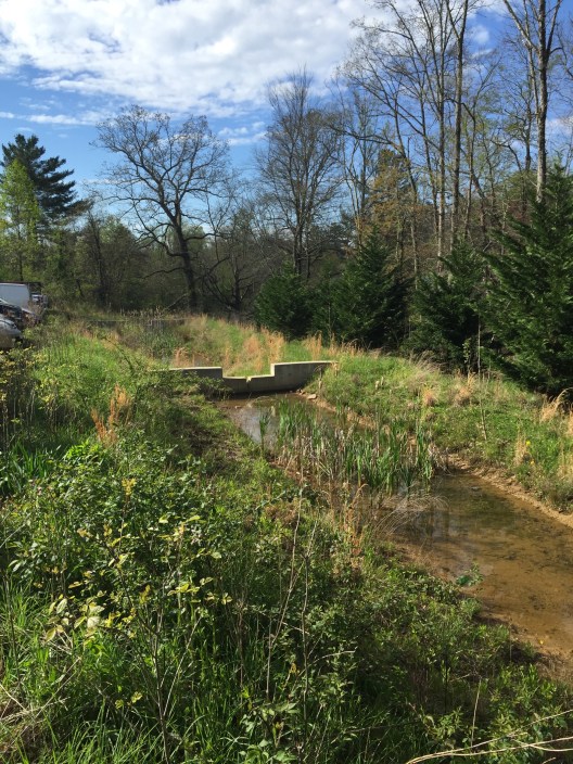
Steel casing of a modern water well protruding from the ground.

Why then, with this efficient method of providing safe access to groundwater, have most people on the Plateau chosen to opt for reservoir water as their drinking water source? The answer lies with issues related to both water quantity and quality. A quick glance at the water well drilling records maintained by the state of Tennessee (or in conversations with well drillers) reveals that the average yield of wells on the Plateau is between 3 and 5 gallons per minute. This might prove satisfactory if one has the ability to store the well water in a large tank, but this does not suffice for a household pumping the water directly from the well into the house. The reason for these low yields is primarily due to the fact that the sandstones and shales of the upper Cumberland Plateau have relatively low permeability. Water travels through these layers mainly along fractures and one must be fortunate enough to have a well that intersects these fractures. Predicting where these fractures are found in the subsurface is not possible. Compare these yields to those from wells drilled in the valley surrounding the Plateau, where wells often produce from 80 to 100 gallons per minute. This increased production is due to the fact that valley wells are drilled into very permeable limestone that is honeycombed with caves and passageways filled with water. Drilling deeper on the Plateau down into the limestone will not increase yield, since caves and associated passageways do not extend beneath the sandstone cap of the Plateau.

Fig3_StratCol_ed
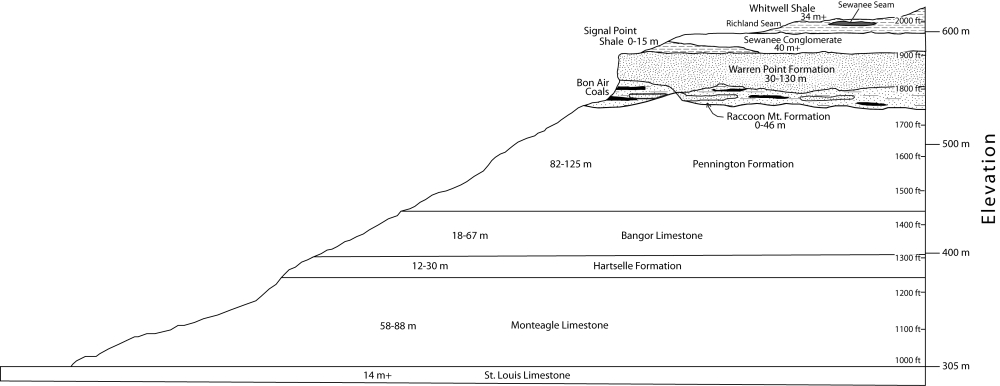
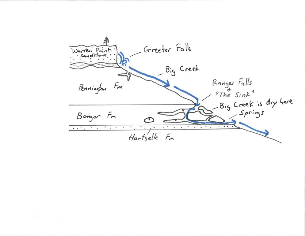
Geologic cross section of the Cumberland Plateau near Sewanee. Rocks above the Raccoon Mountain Formation are relatively impermeable sandstones and shales. Rocks below this layer are chiefly limestones with good permeability given to them by caves and passageways only in areas not under the sandstone cap.


The second problem with well water on the Plateau has to do with reduced quality because of high levels of iron. Now, iron is not considered a primary contaminant in drinking water by the Environmental Protection Agency (EPA). Rather, it is classified as a secondary, or nuisance contaminant, causing stains on bathroom fixtures, turning white laundry pink, and clogging water filters. The general rule of thumb is that the greater the depth from which water is drawn from a well, the higher the iron content will be. This is due to the fact that deeper groundwater contains less dissolved oxygen than shallow water. Dissolved oxygen makes the iron precipitate out of solution (turn solid) and settle out of the water. The same trend is seen in spring water. Shallow springs (like Tremlett Spring in Abbo’s Alley or Hat Rock Spring) are very low in iron. These springs emanate from the Sewanee Conglomerate (see cross section above), which sits on top of the Plateau in the Sewanee area. Deeper springs that emanate from the underlying Warren Point Sandstone have much higher levels of iron and have historically been called chalybeate.

IMG_2026.JPG

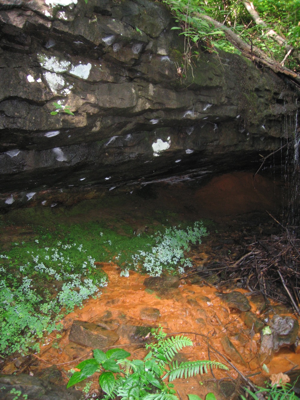
A chalybeate (high iron) spring emanating from the Warren Point Sandstone in Sewanee. As the oxygen-depleted groundwater meets the air, the iron precipitates out as a solid.

The ultimate source of all the iron in the groundwater is from the weathering of iron-bearing minerals in the sandstone.

So, due to low yields and high iron, the vast majority of people on the Plateau have opted for reservoir water (if it was available to them) instead of well water.

From Stone Door to Greeter Falls

Big Creek Gulf Hydrology

IMG_1607

View from Stone Door down into Big Creek Gulf.

One of the best places to witness karst hydrology and beautiful scenery is within the Savage Gulf State Natural Area near Beersheba Springs, Tennessee. Here, three deep gulfs cut by stream erosion dissect the Cumberland Plateau like the imprint of a giant crow’s foot. Big Creek has carved out one of these gulfs and is best accessed via the Stone Door.

stonedoormap

From here one passes through a large joint in the Warren Point Sandstone to drop more than 600 feet along the Big Creek Gulf Trail (BCG trail on map) to the rocky bed of Big Creek. About 100 yards downstream from where the BCG trail meets the creek, several large springs emerge from the hillside on the other side of the stream. This is also the contact between two major rock layers of Mississippian age – the Bangor Formation above and the Hartselle Formation below.

DCIM100GOPRO

Passing through a large joint (the “Stone Door”) to get down to Big Creek.

The occurrence of springs at this stratigraphic level is no coincidence. The overlying Bangor Formation is mainly limestone that has been heavily chemically weathered and contains many cave passageways. The underlying Hartselle Formation, on the other hand, is a calcite-cemented, quartz sandstone with no karst development. It forms an impermeable boundary to groundwater flow and the downward development of caves within the Bangor.

DCIM100GOPRO

Spring emanating from the contact of the Hartselle and Bangor Formations on the banks of Big Creek.

0157_001

Highly simplified cross-section showing relationship of hydrology to geology along Big Creek.

Moving upstream from the springs the bed of Big Creek is dry. The imbricated and polished rocks of the bed, along with high water debris lines and bent over trees clearly indicate that there is a vigorous flow of water here at certain times.

IMG_1617

Dry bed of Big Creek above the springs and below Ranger Falls and “The Sink.”

DSCN2882.JPG

A boulder in the dry bed of Big Creek showing the recent claw marks of a black bear.

Further upstream at both Ranger Falls and “The Sink” (see map above), one is greeted with the sound of flowing water. Both places mark the top of the Bangor Formation where it contacts the overlying Pennington Formation. Here water flowing across the surface of the relatively impermeable Pennington quickly disappears into the caverns of the Bangor.

DSCN2902.JPG

Big Creek water disappearing into caverns within the Bangor Formation at “The Sink.”

DCIM100GOPRO

Ranger Falls, where water cascades over cliffs of the Pennington Formation and dives into a cavern system in the Bangor Formation.

Because the Pennington Formation contains numerous shale layers interbedded with limestones and dolomite, it does not conduct groundwater to the extent that the Bangor does. It also has far fewer and smaller caves. Upstream from “The Sink” Big Creek flows above ground and, for the hiker, culminates at Greeter Falls. During heavy or prolonged rains, the karst system of the Bangor Formation is overwhelmed by water and Big Creek is characterized by a continuous flow along its entire length. Thus the karst hydrology is best detected during relatively dry periods.

The Rain Barrel Myth

IMG_1538


Go to any of the dozens of websites dealing with rain barrels and you’ll find the same claims. Rain barrels are a great way to get free water for watering plants, to hedge against droughts, and to help protect the environment by reducing stormwater. The claims are made by universities and state and private conservation agencies alike. These 55 – gallon containers are simply set beneath a downspout to capture rain water off your roof. They can be set up in an array to maximize the capture. Most home improvement and gardening stores sell them (usually for over $100 each). Certainly they are a great way to capture free water for your plants, but what about the claim that you are helping the environment by reducing stormwater in your watershed? It turns out that if you do the math, rain barrels do virtually nothing to reduce stormwater.

Let’s take a look at a watershed in the town of Sewanee on the Cumberland Plateau. Here the upper Abbo’s Alley watershed (70 acres) goes into flood stage between 15 and 25 times per year. During these floods stormwater erodes stream banks and causes loss of soil from the watershed. It is known (see previous post – link at bottom) that during storms, about 40% of the rain that falls on this watershed enters the stream directly across the ground surface to become stormwater. Now imagine a 2 inch storm event.

2 inches = 0.167 feet and the 70 acres of the watershed = 3,049,300 square feet

To get the volume of water that falls on the watershed during a 2 inch event, multiply the rain amount by the surface area of the watershed:

(0.167 ft.) X (3,049,300 square ft.) = 509,216 cubic ft., which is the same as 3,809,200 gallons.

40% of 3,809,200 gallons turns into stormwater. This is 1,523,680 gallons.

If there were 60 rain barrels on the watershed (about 2 per house), then (if they were empty at the start of the rain) we could capture 3,300 gallons (60 X 55) of roof water, preventing it from going into the stream.

3,300 gallons divided by 1,523,680 gallons = 0.216%

So, all those rain barrels would only reduce storm flow by 0.216% and the barrels become even less effective for larger rain events.

The main problem with this misconception is that it gives people the false impression that they are reducing stormwater in some significant way and they may therefore be less inclined to support more aggressive stormwater control measures. Why support the construction of a big, ugly detention basin in the watershed when rain barrels can do the job? So sure, use rain barrels for watering plants – they are great for this. But understand that really being able to control and reduce stormwater on the Cumberland Plateau demands a more aggressive approach involving rain gardens, bioswales and detention basins.

Stormwater on the Plateau

The portion of the campus of the University of the South that sits atop the plateau is comprised of more than 50 first-order catchments, ranging in size from 4 to over 61 ha. The vast majority of the streams are intermittent, flowing only during the winter and spring months, and rarely during particularly wet summers and autumns. The few perennial streams, such as Abbo’s Alley, are typically fed year-round by springs. During storms (usually defined by hydrologists as at least 1 inch of rain per hour) soils are quickly saturated and much water flows directly to streams as overland flow, often resulting in a dramatic rise in stream level. In non-urbanized catchments on the plateau, about 20%– 25% of the rain that falls during such a storm enters the stream as overland flow (hydrologists refer to this as the “hydrologic response” of the watershed). This is due primarily to thin (0–5.2 m, 1.2 m average), sandy loams that overlie the relatively impermeable sandstones and conglomerates of the plateau top. As expected, partly urbanized catchments on campus have significantly higher hydrologic responses. Here, impermeable surfaces such as roads, sidewalks, roof tops, and parking lots create increased amounts of overland flow. The upper Abbo’s Alley area is such a catchment, exhibiting a hydrologic response to storm events of ~40%. This is primarily due to the catchment consisting of 20% impermeable surfaces (rooftops, roads, sidewalks, etc.). Additionally, extensive grass surfaces in yards and parks have infiltration rates (10–100 mL/min) that are lower than those of the undisturbed, nearby forest fl oor (250–300 mL/min). Stormwater in urbanized catchments is not directed into the sewer system. Rather, the storm drains that one sees along roadsides and parking lots direct water into the nearest drainage.

IMG_0716

Storm drain with marker on Sewanee’s campus.

Print

The diagram above shows storm hydrographs for Abbo’s Alley and Split Creek, a 100% forested, undeveloped catchment of similar size on the campus. These hydrographs were generated during the same rain event (5.9 cm in one hour) in November 2006 and demonstrate the increased hydrologic response of partly urbanized watersheds in the area.   Notice that the Abbo’s Alley stream rises much more dramatically in response to the storm compared to the Split Creek stream.

Slide1

Abbo’s Alley stream during normal flow (left) and during a storm event (right).

Below is a description of a storm event at Abbo’s Alley from a Sewanee student:

“… At 5:53 the Abbo’s Alley watershed was experiencing a downpour. It began to thunder and lightning, and the stream rose enormously. A fast spike in the water level occurred, then the level fell again before rising to the peak. Between 6:00 and 6:30 a wave of insects washed by clinging to floating brown leaves (last fall’s leaves) and a few dog toys floated down the stream, along with a beer can and several salamanders. Around 6:10 water began to flow over the road about 30 meters closer to the meadow where Hodgson Pond used to be instead of through the culvert. At 6:19 peak flow was attained and the culvert was completely full of water. At 6:38 the rain stopped and the sky began to clear. It was partly cloudy until after sunset when another storm system began to move in and cloud over the sky.”

The increased stormwater flow in urbanized watersheds means they are also characterized by higher degrees of erosion and soil loss compared to their undeveloped counterparts, exhibiting steeper, higher stream banks, undercut stream banks, and exposed roots (see photo below). Plateau catchments often show macropore development along the axis of the stream channel. Here, erosion has created karst-like, sinuous passages in the soil. These macropore systems are discontinuous along the length of the stream channel, and therefore alternately move water above and below ground. In developed watersheds, these macropore systems often become overwhelmed with water during storm events, leading to accelerated lateral and upward erosion. Occasionally, this upward-enhanced erosion breaches the surface of the ground, leaving tree roots suspended across the resulting open channel (see photo below). Such “macropore blowout” structures are the hallmark of increased erosion on developed watersheds on the plateau.

Blowout

“Macropore blowout” structure behind range pole in stream on an urbanized watershed on the campus of the University of the South. Notice lateral erosion, bank undercutting, and sandstone bedrock stream floor. Range pole divided into 1 foot sections.

Some significant differences in water quality may be detected during storm events between developed and non- developed watersheds. The former are characterized by increased levels of Na, Ca, and Mg. Increased Na is attributed to winter road salting, while Ca and Mg are likely derived from weathering of carbonate road gravels. First- flush sampling on developed watersheds has also indicated the presence of oil and grease (<5 ppm), while non-developed watersheds have remained free of these contaminants. Finally, pH values on developed watersheds range from 7.2 to 7.6, compared to 4.6–5.5 on non-developed counterparts during all flow conditions. This elevation of pH is likely due to the presence of carbonate road gravel and concrete in the developed catchments.

The University of the South has recently taken more aggressive steps in order to minimize the negative effects of increased stormwater flow in urbanized catchments. Prior to 2010, the only evidence of stormwater flow control on campus was limestone rip-rap that was strategically placed to reduce erosion. With the renovation of Snowden Forestry Building in 2010, a large bioswale was constructed to filter roof water from the building. The bioswale is sufficiently large to accept roof water from the new Ayers Hall dormitory, which is currently under construction. A bioswale is a depression that is filled with permeable materials designed to slow and filter water as it passes through.

IMG_1546

Bioswale that will accept roof water from Ayers Hall (foreground) and Snowden Hall (near background).

Additionally, several detention basins have been constructed adjacent to parking lots, dorms, and on the University’s golf course. These basins temporarily hold stormwater, permitting sediment to settle out and slowing the water down.

IMG_1542

Tiered detention basins adjacent to student parking lot.